May 31, 2023
![]() 10 mins Read
10 mins Read
It’s renowned for its iconic coastal trails but searching ‘bush walks near me’ from anywhere in Sydney will unearth magnificent water-gawking treks complemented by further natural wonders. From walks that encircle the very best whale-watching vantage points to trails that lead to the city’s most secret swimming spots, action-packed inland paths lie far and wide.
One of Sydney’s ultimate picnic spots lies at the end of the America Bay Walking Track underneath a cascading waterfall surrounded by dense bush. The track follows a sandstone ridge, sitting beneath a canopy of lush gum trees. Look closely and you’ll find watering holes hidden between red rocks that are filled with yabbies and tadpoles.
Getting there: America Bay is in the West Head precinct of Ku-ring-gai Chase National Park. Driving here is the best option, however, the track is also accessible from the waterfront if you’re lucky enough to have access to a boat (or tinnie).
Distance: 1.8 kilometres return
Level: Medium
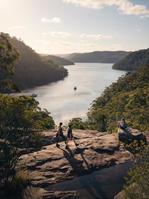
America Bay Walking Track follows a sandstone ridge, sitting beneath a canopy of lush gum trees. (Image: Destination NSW)
Gaze out over a sweeping view of Sydney Harbour and the bustling CBD from North Head Sanctuary. Its Sanctuary Loop walk goes past Sydney’s former Army School of Artillery, as well as the Third Quarantine Cemetery which was built in 1881 and offers a prime example of how our quarantine processes evolved over time.

Marvel at The Sanctuary, Q Station North Head Sydney Harbour National Park. (Image: John Yurasek/DPE)
Hanging swamps and banksia scrub make up some of the unique vegetation along the track. Stop and cool off at one of the cute little beaches along the way, and finish with a coffee at Bella Vista Cafe up on the headland.
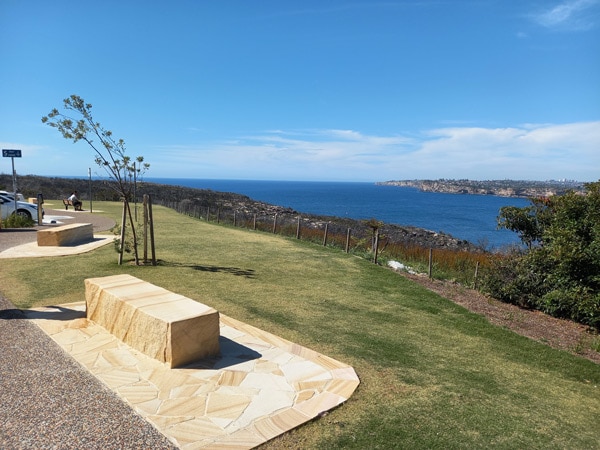
Admire the scenic landscape at North Head Sydney Harbour National Park. (Image: Katherine Ashley-DPE)
Getting there: A bus to North Head Sanctuary from Manly Wharf runs regularly. There’s also a bike path running all the way from the Wharf to North Head Sanctuary.
Distance: Two-hour loop
Level: Easy
Combining the best of the bush with the best of the ocean, the Harold Reid Foreshore Track covers Middle Harbour and much of its staggering beauty. Highlights include the Harold Reid Headland, also referred to as Sugarloaf, a sandstone structure that dramatically looms above sea level for your viewing pleasure. Featuring slippery surfaces and rocky terrain at times, the track is suitable for families but just make sure everyone’s got the right footwear. You’ll spy an array of birdlife including Grey Fantails, Kookaburras and Superb Fairy-wrens, plus views out to Castlecrag’s stunning Innisfallen Castle, mangroves and a picnic area with a gas barbecue.
Getting there: Start your trail at the end of Sugarloaf Crescent in Castlecrag. You can park your car on the street right before hitting the signpost marking the track’s entrance.
Distance: four-kilometre loop
Level: Easy to medium
A long but easy walk that winds through thick mangroves and bushes overflowing with red bloodwoods and apple gums. Start at the Sphinx Memorial, a striking sandstone monument built in memory of the lives lost during the First World War.
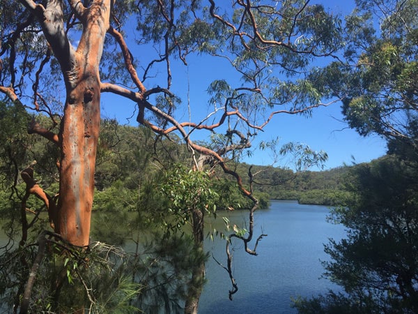
You’ll stop by a river surrounded by thick mangroves. (Image: Natasha Webb/DPE)
End at Bobbin Head where you’ll find an abundance of picnic tables and barbeques. If you haven’t packed a spread, it’s all good. Waterside Bistro is just around the corner within Empire Marina and serves up a mouth-watering selection of burgers, seafood, and hearty salads.
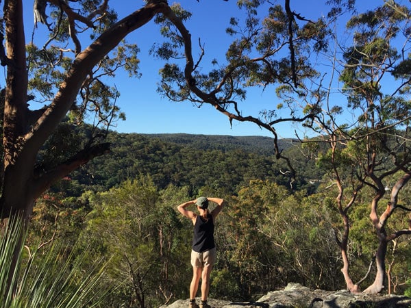
Rest mid-hike to appreciate the scenery. (Image: Natasha Webb/DPE)
Getting there: Sphinx Memorial is another one of those places you’ll need a car to get to, with plenty of parking available at the grounds. Follow Bobbin Head Road from the Pacific Highway at Turramurra.
Distance: 10-kilometre loop
Level: Easy
Discover some of Sydney’s most stunning less-lazed-upon beaches all in one day with the Resolute Beach Circuit Walk. Offering access to Resolute Beach, one of Sydney’s best covert swimming spots, this sometimes-steep trek also covers West Head and Great Mackerel beaches. And once you’re navigated the trail speckled with rich flora and fauna and plonk yourself on Resolute itself, you’ll be treated further to views across Pittwater and Barrenjoey Headland.
Getting there: The Circuit Walk consists of two trails; one starts from the Resolute Picnic Area at the end of West Head Road where you’ll find a car park. The other starts at the West Head Lookout, which is closed and undergoing maintenance until November 2023 but is accessible from the Resolute Picnic Area when it’s back up and running.
Distance: 6-kilometre loop
Level: Medium to hard
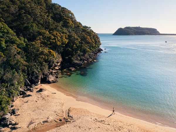
Discover some of Sydney’s most stunning less-lazed-upon beaches all in one day with the Resolute Beach Circuit Walk. (Image: Destination NSW)
Pack a picnic lunch and immerse yourself in lush bushlands along the Riverside Walking Track. Featuring multiple picturesque spots to spread out a feast, the peaceful trail runs along the Lane Cove River so exploring will be freckled with water views. Spend the rest of your journey soaking up an incredible roster of birdlife as well as the odd swamp wallaby. And pesky bush turkeys? You’ll find them everywhere, providing plenty to keep littler ones entertained.
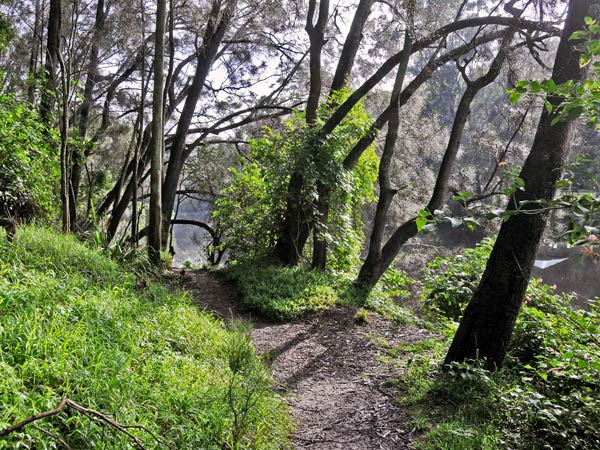
Pass through the foggy Riverside Walking Track. (Image: Kevin McGrath/DPE)
Getting there: Reach the trail from either Delhi Road in West Chatswood or Lane Cove Road in Macquarie Park. There’s parking up for grabs along the entire stretch including the Koonjeree Picnic Area towards the southern end of the trail.
Distance: 5 kilometres one-way
Level: Easy to medium
A longish but flat walk that promises remarkable coastal views and one of the most popular whale spotting sites in Sydney. Scribbly gums huddle at the edge of the Curra Moors Loop Track which opens onto a blossoming heath and ocean-facing sandstone cliffs. During spring, the flora will give your nostrils a delightful sensory experience and you may be lucky enough to spot echidnas roaming amongst the shrubbery.
Getting there: Getting to the Royal National Park from the CBD via public transport can be time-consuming (with no direct links), so driving here is the way to go. Vehicle passes are $12 for the day. Parking can be at a premium here on the weekends so get here early.
Distance: 10-kilometre loop
Level: Medium
Pack up and disappear for a few days by hiking the Benowie Walking Track, running between Pennant Hills and Berowra Waters. A mixture of smooth boardwalk and uneven dirt that winds steadily amid rural bushland, it’s the perfect pick if you’re planning to camp along the way.
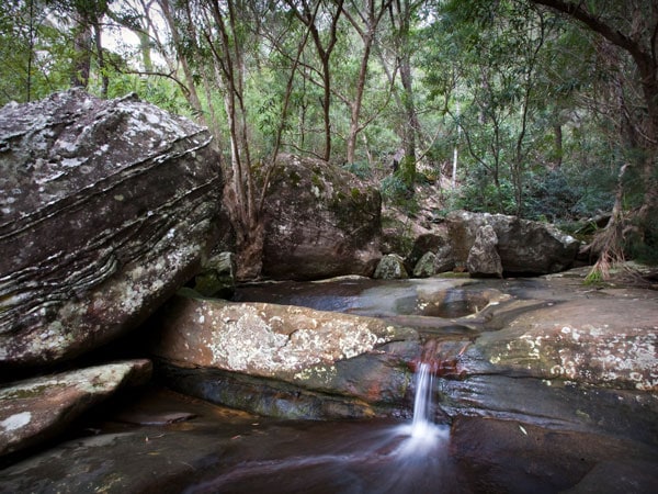
Make a splash in the cold water cascades at Berowra Creek. (Image: Nick Cubbin/DPE)
Lined with Sydney blue gums and budding black wattles, Benowie is just one part of the Great North Walk, stretching from Sydney to Newcastle. Be sure to keep your eyes peeled – you may stumble across ancient Aboriginal rock carvings or the remnants of an old quarry.
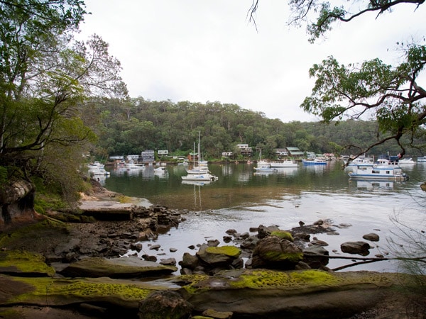
Walk past the boats and houses along Benowie Walking Track. (Image: Nick Cubbin/DPE)
Getting there: Most tracks out of Sydney require a car, however this one’s only one kilometre from either Hornsby or Pennant Hills train station.
Distance: 25 kilometres one-way
Level: Hard
Sydney’s longest coastal trail showcases two of the city’s most outstanding locales, blending beautiful bushwalking with exceptional ocean-gazing. The Bondi to Manly Walk will take you anywhere from two to six days, depending on your unique pace. Our advice? Savour the stretch and go slow. You’ll be spoilt with natural rockpools, dramatic sandstone cliffs, secluded swimming spots and beaches, world-famous headlands, the Sydney Harbour Bridge, Taronga Zoo and a string of fascinating historical remains and fixtures. Best of all, no part of the walk is overtly strenuous, and it’s clearly signposted from start to finish. The only reason it’s rated hard is due to its colossal length. There’s even an app that offers step-by-step guidance.
Getting there: Start from Bondi Beach and make your way south along the South Head of Sydney’s Eastern suburbs. Buses travel to Bondi Beach from Bondi Junction regularly every day.
Distance: 80 kilometres
Level: Hard
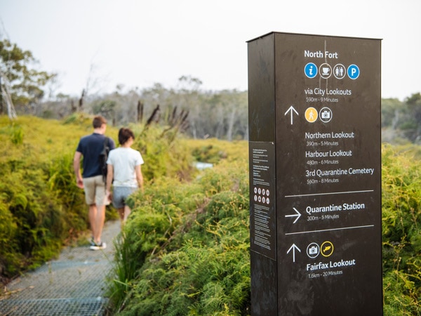
The Bondi to Manly Walk will take you anywhere from two to six days. (Image: Destination NSW)
Google everything you can about the trail you’re tackling. Get a feel of the route, particularly if it’s a long one, and check the difficulty level even if you’re an experienced bushwalker. Conditions change and sections may be undergoing maintenance so always gather as much information as possible prior to go-time so there are no surprises.
It’s a no-brainer but should be reminded. Ensure your walk isn’t rained out or overheated unexpectedly.
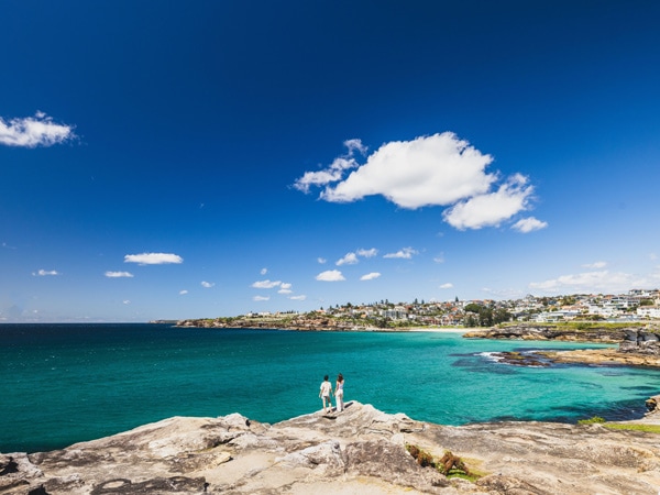
Research and plan before you head on a coastal walk. (Image: Destination NSW)
No matter where your journey takes you, waterproof and windproof clothing is your best bet and layering tops makes it easy to cool down as the day heats up. Plus, opting for long, loose pants will keep insects and grazes at bay. Choose sturdy, protective shoes with soles that grip and don’t forget a hat.
Here’s the checklist: sunscreen, insect repellent, more than two litres of water per person, nutritious snacks, a torch, a simple first aid kit that includes Band-Aids, antiseptic and small scissors and your mobile phone and/or a map. If you’re camping, you’ll need a tent and sleeping bag at a minimum.
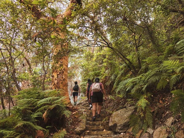
Make sure you’re prepared and pack everything you need. (Image: Destination NSW)
The NSW National Parks app contains up-to-date information on hundreds of Sydney’s best walks. Plus, you can download your route before you go so even if you’re out of range, your map will remain a click away.
Finally, make sure somebody knows you’re heading out and may be uncontactable due to trekking outside of phone satellite proximity. It may seem extreme, but accidents can happen and it’s better to err on the side of caution if you’re planning an epic adventure.
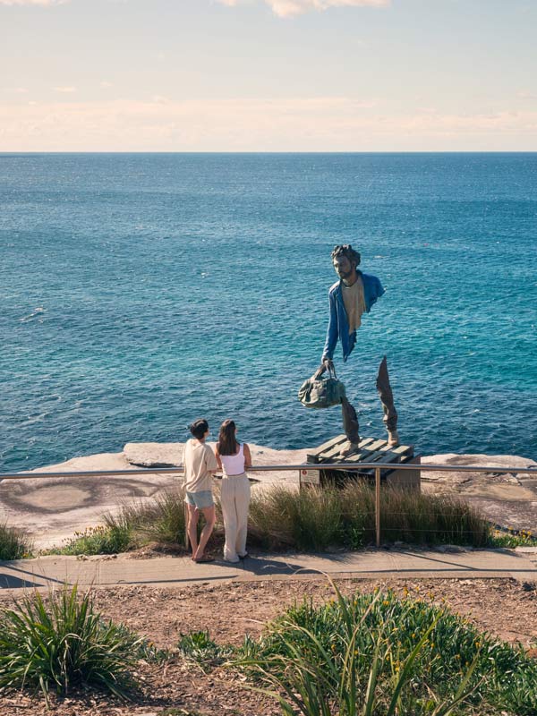
Make sure somebody knows you’re heading out on a walk. (Image: Destination NSW)
For the  best travel inspiration delivered straight to your door.
Great selection. A cut above the usual Sydney bushwalk guide. We’ll done!
I live in Scotland but come to Sydney every two years and stay at my Daughters in South Coogee
so know The Coogee to Bondi walkway well but thanks for your article which will now give me a chance to try some of the other walks when I return to Sydney in December.