The Red Centre Way is a classic outback journey saturated with both legendary and less renowned Australian icons. Starting and finishing in Alice Springs, the route covers around 1140km and runs through the very heart of the Australian outback, linking the MacDonnell Ranges and Watarrka National Park (Kings Canyon) with Uluru and Kata Tjuta (The Olgas) in one big loop.

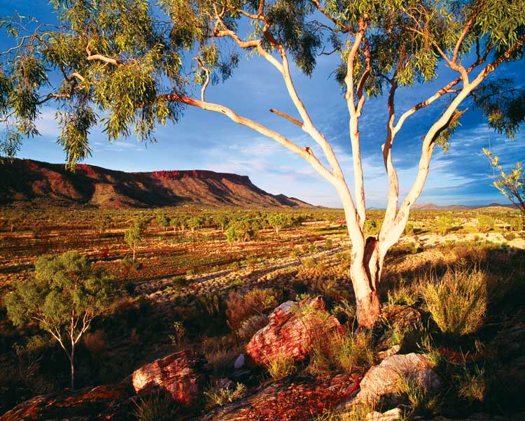
The West MacDonnell Ranges from the road AKA The Red Centre Way
Heading west from Alice, the first part of the track winds through the majestic MacDonnell Ranges to Glen Helen, scattered throughout with natural wonders sculpted over millions of years creating breathtaking scenery; areas such as Simpsons Gap, Standley Chasm, Ellery Creek Big Hole and Ormiston Gorge, which include great walking tracks, cooling rock pools and magnificent views.

The near-permanent oasis of Ormiston Gorge on the Larapinta Trail is accessed also by road on the Red Centre Way.

All yours: Standley Chasm, Larapinta Trek.
From Glen Helen the road continues another 260km to Watarrka National Park along the Mereenie Loop. This is an unsealed road that can be tackled with a 2WD, but a 4WD is definitely recommended, and is a must after rain. You’ll also need a permit, available at the humble sum of $2.20.

Perched on the edge of the 270m-deep Kings Canyon.
The most famous part of Watarrka is Kings Canyon, which splits the Earth to a depth of 270m providing shelter for palms, ferns and cycads, creating a tropical oasis in the middle of the otherwise brittle surrounds. From here the track continues another 300km to Uluru and Kata Tjuta, the two most famous landmarks within the Kata Tjuta National Park – if not all of Australia.
Now this might sound strange, but as you close in on Uluru try and resist the temptation to spot the Rock in the distance, hunched on the horizon. Instead, if you get the opportunity, drive out to a pre-dawn viewing point and watch as the first rays of light bring everything to life. Uluru will slowly appear out of the darkness, changing in colour as the sun rises higher in the sky. An astounding way to first lay eyes on this natural wonder and definitely worth losing a few hours sleep for.
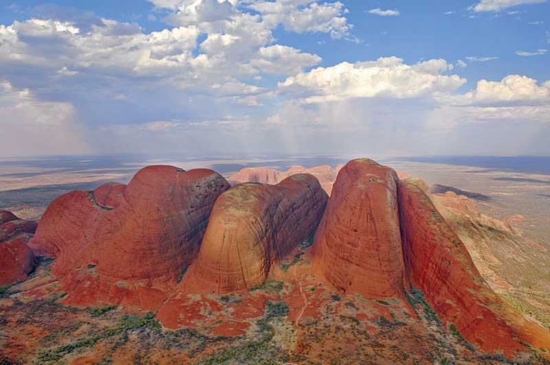
Further down the track, 30km west of Uluru, lie the 36 large rock domes of Kata Tjuta (the Olgas), which many consider even more curious and dramatic in shape and appearance than the Rock itself. The tallest, Mount Olga, reaches 546m above the surrounding plain.

The amazing sight of Kata Tjuta from the air. – Tourism NT
The last stretch of road, from Uluru back to Alice Springs, is another 445km. A classic stop along the way is Rainbow Valley, just east of the Stuart Highway, not far from Alice. Here, sandstone bluffs and cliffs put on a colourful rainbow-like show in the early mornings and late afternoons when the sun highlights the iron-rich/iron-poor bands of the sandstone.
Who got there first? // Ernest Giles was the first white man brave enough to challenge the unforgiving heart of Australia. During his first expedition in 1872, he spotted Uluru and Kata Tjuta in the distance – but the first European to actually touch the rock was William Gosse, following Giles’ original route in 1873. Consequently, Gosse got first dibs on naming it – and did so after SA Premier Sir Henry Ayers.
Don’t miss // Dawn and dusk are pretty magical moments anywhere in the outback, but two particular moments you really should take in are the sunset and sunrise viewings of Uluru. It’s not something you’ll soon forget.
Drive Time // The Red Centre Way is around 1135km in total, but allow at least five days – preferably far more – to explore the area in detail.
1. Uluru and its many associated Dreamtime stories are fundamental to the spiritual beliefs of the local Anangu people. It’s sacred ground and they’d prefer if you did not climb it before it closes once and for all on October 26th 2019. Here are our five reasons you should not climb the rock.
2. Remember that it’s an offence to the Anangu to photograph or film areas of spiritual significance, which are clearly signposted. If in doubt, ask.
3. There’s more than one large rock out there. Mistaking Mt Connor for Uluru and squealing like a schoolgirl can be embarrassing, so try not to do that.
4. Don’t forget your fly net. If you haven’t been to the Red Centre and think you’ve seen flies in numbers before, think again.
5. Discover just before sundown that you only packed singlets and shorts and you could be in for a painful night, so consider the time of year. Summer temps are 22-37ºC; winter temps are 4-19ºC.
Accessibility // Large parts of the drive are suitable for a 2WD, although it’s recommended you use 4WD drive for the Mereenie Loop and many other sidetracks.
Did you know? // The visible height of Uluru is 348m, but that’s actually only a small portion of the entire rock. Geologists say at least another 6km of Uluru is hidden underneath the surface.
More info // Visit northernterritory.com for more, including info on permits and maps.

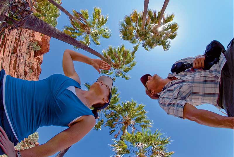
Palm Valley south of Hermannsburg. – Tourism NT
1. Hermannsburg // The site of Australia’s most famous Lutheran mission. Close by you’ll also find the memorial of the late Aboriginal artist Albert Namatjira.
2. Finke Gorge and Palm Valley // A tropical oasis south of Hermannsburg with thousands of red cabbage palms found nowhere else in the world.
3 .Mt Sonder // 40km northwest of Glen Helen, a great way to test your physique and admire the uninterrupted view from 1380m up.
4. Curtin Springs // A working cattle station 85km east of Uluru from which you can explore Mt Connor and visit the grave of Ellis Bankin, who for died mysteriously in 1936 when he tried to reach Uluru from Ernabella station on his motorcycle. Although the story of Ellis was forgotten for many generations, it was recently rediscovered and a plaque erected to celebrate the life of such an adventurous and curious spirit.
5. Lasseter’s Cave // 191km from Yulara, this is where gold prospector Lewis Harold Bell Lasseter became stranded in 1931 after his camels made a run for it. He spent 25 days in the cave before deciding to walk to the Olgas. He died after having walked just 55km.
For the  best travel inspiration delivered straight to your door.
Really interesting, useful article.